Showing posts with label Heritage Australia. Show all posts

Purnululu National Park

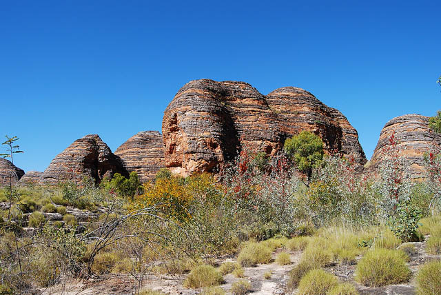
The 239,723 ha Purnululu National Park is located in the State of Western Australia. It contains the deeply dissected Bungle Bungle Range composed of Devonian-age quartz sandstone eroded over a period of 20 million years into a series of beehive-shaped towers or cones, whose steeply sloping surfaces are distinctly marked by regular horizontal bands of dark-grey cyanobacterial crust (single-celled photosynthetic organisms). These outstanding examples of cone karst owe their existence and uniqueness to several interacting geological, biological, erosional and climatic phenomena.

image
Cathedral Gorge, Purnululu National Park

Earth’s history and geological features The claim to outstanding universal geological value is made for the Bungle Bungle Range. The Bungle Bungles are, by far, the most outstanding example of cone karst in sandstones anywhere in the world and owe their existence and uniqueness to several interacting geological, biological, erosional and climatic phenomena. The sandstone karst of PNP is of great scientific importance in demonstrating so clearly the process of cone karst formation on sandstone - a phenomenon recognised by geomorphologists only over the past 25 years and still incompletely understood, despite recently renewed interest and research. The Bungle Bungle Ranges of PNP also display to an exceptional degree evidence of geomorphic processes of dissolution, weathering and erosion in the evolution of landforms under a savannah climatic regime within an ancient, stable sedimentary landscape. IUCN considers that the nominated site meets this criterion.

image

Superlative natural phenomena or natural beauty and aesthetic importance Although PNP has been widely known in Australia only during the past 20 years and it remains relatively inaccessible, it has become recognised internationally for its exceptional natural beauty. The prime scenic attraction is the extraordinary array of banded, beehive-shaped cone towers comprising the Bungle Bungle Range. These have become emblematic of the park and are internationally renowned among Australia’s natural attractions. The dramatically sculptured structures, unrivalled in their scale, extent, grandeur and diversity of forms anywhere in the world, undergo remarkable seasonal variation in appearance, including striking colour transition following rain. The intricate maze of towers is accentuated by sinuous, narrow, sheer-sided gorges lined with majestic Livistona fan palms. These and the soaring cliffs up to 250 m high are cut by seasonal waterfalls and pools, creating the major tourist attractions in the park, with evocative names such as Echidna Chasm, and Frog Hole, Piccaninny and Cathedral Gorges. The diversity of landforms and ecosystems elsewhere in the park are representative of the larger region, and lack a unique aesthetic quality, but provide a sympathetic visual buffer for the massif. The powerful aesthetic experience of the Bungle Bungles has aroused huge interest among the public, and the ranges figure prominently in national and international advertising of Australia’s tourist attractions, matching the prominence of the Uluru-Kata Tjuta National Park. Photographers and travel writers include the Bungle Bungles among the world’s natural wonders, some describing them as Australia’s equivalent of the Grand Canyon.

image

Purnululu National Park is located in the East Kimberley Region of Western Australia located 300 km by road south of Kununurra in Western Australia's Ord Region; the listed area is almost 240,000 ha. There is an adjacent buffer zone to the north and west (the Purnululu Conservation Zone) of approximately 79,600 ha, which is not part of the nominated area. The park comprises four major ecosystems: the Bungle Bungle Mountain Range, a deeply dissected plateau that dominates the centre of the park; wide sand plains surrounding the Bungle Bungles; the Ord River valley to the east and south of the park; and limestone ridges and ranges to the west and north of the park.
image

The Bungle Bungle Mountains are an unusual and very dramatic plateau of Devonian quartz sandstone, created through a complex process of sedimentation, compaction, uplift (caused by the collision of Gondwanaland and Laurasia approximately 300 million years ago and the convergence of the Indo-Australian Plate and the Pacific Plate 20 million years ago), as well as long periods of erosion. The Bungle Bungle landscape comprises a mass of beehive-shaped towers with regularly alternating, dark grey bands of cynobacterial crust (single-cell photosynthetic organisms). The plateau is dissected by 100-200 m deep, sheer-sided gorges. The cone-towers are steep-sided, with an abrupt break of slope at the base and have domed summits. Their surface is fragile but stabilized by crusts of iron oxide and bacteria. They provide an outstanding example of land formation by dissolutional weathering of sandstone, with removal of sand grains by wind, rain and sheet wash on slopes.

image

The Bungle Bungle Range is one of the most extensive and impressive occurrences of sandstone tower karst in the world. The grassy Ord River valley on the east and south of the park is deeply incised as a result of crustal uplifting during relatively recent geological times. The wide sand plains between the uplands and the river are composed of infertile black soil covered with grassland and scattered trees. The limestone ridges to the west and Osmand Range to the north are better wooded, especially in the forested Osmand Creek valley. These rocks are believed to be of Cambrian age (550-500 million years old). There are stromatolites in the Osmand range. Purnululu also has a rich Aboriginal cultural heritage spanning over some 20,000 years. The park provides exceptional testimony to this hunter-gatherer cultural tradition, which has survived to the present day despite the impact of colonization.

image

image

image

image

image

image

image

Text source:- Wikipedia. Images are copyrighted by their owners. Found any copyright issue, contact the administrator immediately. Report it now!
You have read this article Australia / Heritage / Heritage Australia / Heritage Natural / Heritage Oceania / National Parks / National Parks Australia / National Parks Oceania / Oceania with the title Heritage Australia. You can bookmark this page URL https://tiffanyeatworld.blogspot.com/2012/01/purnululu-national-park.html. Thanks!

Gondwana Rainforests of Australia

This site, comprising several protected areas, is situated predominantly along the Great Escarpment on Australia’s east coast. The outstanding geological features displayed around shield volcanic craters and the high number of rare and threatened rainforest species are of international significance for science and conservation.

image
Coomera Gorge Lamington National Park

With the opening of the Gwydir Highway in December 1960, the Gibraltar Range became accessible and moves were initiated to establish a national park. Approximately 14,000ha was reserved for public recreation by notification in the Government Gazette of 8 March 1963 and further 1,425ha was added by notification in the Government Gazette of 17 September 1965. The area was formally created a national park under the National Parks and Wildlife Act, 1967. Further land was incorporated with the park by proclamation in the Government Gazette of 24 December 1970 (c. 105ha) and 1 July 1977 (c. 1,790ha). Washpool National Park was reserved under the Forestry Revocation and National Parks Reservation Act, 1983. Inscribed on the World Heritage List in 1986.

image

image

image

image

image

image

image

image

image

image

image

image

image

image

image

Text source:- Wikipedia. Images are copyrighted by their owners. Found any copyright issue, contact the administrator immediately. Report it now!
You have read this article Australia / Heritage / Heritage Australia / Heritage Natural / National Parks / National Parks Australia / Oceania with the title Heritage Australia. You can bookmark this page URL https://tiffanyeatworld.blogspot.com/2012/01/gondwana-rainforests-of-australia.html. Thanks!

Lord Howe Island Group

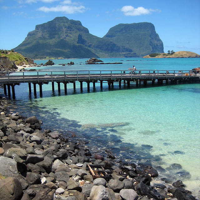
A remarkable example of isolated oceanic islands, born of volcanic activity more than 2,000 m under the sea, these islands boast a spectacular topography and are home to numerous endemic species, especially birds. Located in the South Pacific, 700 km north-east of Sydney, the property is included administratively in New South Wales. The preserve includes some 75% of the land area of Lord Howe Island and all of the offshore islands and rocks of significant size in the region. These are the Admiralty Group; Mutton Bird and Sail Rock; Blackburn (Rabbit) Island; Gower Island; and Ball's Pyramid, together with a number of small islands and rocks. The seaward boundary follows the mean high water mark and consequently excludes all littoral and marine areas. The entire island group has remarkable volcanic exposures not known elsewhere.

image
Lord Howe Island, Australia

The main island of Lord Howe measures 10 km from north and south and is little more than 2 km in width. It roughly describes a crescent, enclosing a coral reef lagoon on its south-western side. The island's topography is dominated by the southerly Mount Gower and Mount Lidgbird. Only a narrow isthmus of lowland country in the north-central part of the island is habitable. The northern tip consists of steep hillsides culminating in extensive sea cliffs against the northern coastline.

image

image

Lord Howe Island is the eroded remnant of a large shield volcano which erupted from the sea floor intermittently for about 500,000 years in the late Miocene (6.5-7 million years ago). The island group represents the exposed peaks of a large volcanic seamount which is about 65 km long and 24 km wide and which rises from ocean depths of over 1,800 m. Four separate series of volcanic rocks are recognized on the main island group: tuffs, breccia and basalts, with widespread intrusion of basaltic dykes. The dominant landforming process on Lord Howe since the last of the volcanic eruptions has been marine erosion, which has cut and maintained major cliffs. Slope failure and accumulation of talus at the foot of some cliffs, especially in the south, have modified their original shape.

image

image

The island supports the southern truest coral reef in the world, which is of Pleistocene to Recent Age and differs considerably from more northerly warm water reefs. It is unique in being a transition between the algal and coral reef, due to fluctuations of hot and cold water around the island. A wide variety of vegetation types has been described for the islands, with the diversity corresponding with the range of habitats. Variable exposure to wind and penetration of salt spray appear to be the main determinants of vegetation occurrence, structure and floristic.

image

image

A population of the large forest bat occurs on the Island. No other indigenous native mammals are known. Introduced species, however, include mice, rats and goats. There are at least 129 native and introduced bird species. Lord Howe is now the only known breeding ground for providence petrel. Fleshy-footed shearwater breeds in large numbers, with possibly half the world's population present seasonally. Other important species breeding within the preserve include kermadec petrel, black-winged petrel, wedge-tailed shearwater, little shearwater, white-bellied storm petrel, masked booby, and red-tailed tropic bird in greater concentrations than probably anywhere else in the world.

image

image

The earliest European discovery of Lord Howe appears to have been in 1788 by the British. A small permanent settlement was established in the 19th century, subsisting on trade with passing ships. There is no recognized evidence of prior Polynesian or Melanesian discovery or settlement.

image

image

image

Text source:- Wikipedia. Images are copyrighted by their owners. Found any copyright issue, contact the administrator immediately. Report it now!
You have read this article Australia / Heritage / Heritage Australia / Heritage Natural / Islands / Oceania with the title Heritage Australia. You can bookmark this page URL https://tiffanyeatworld.blogspot.com/2011/12/lord-howe-island-group.html. Thanks!

Uluru

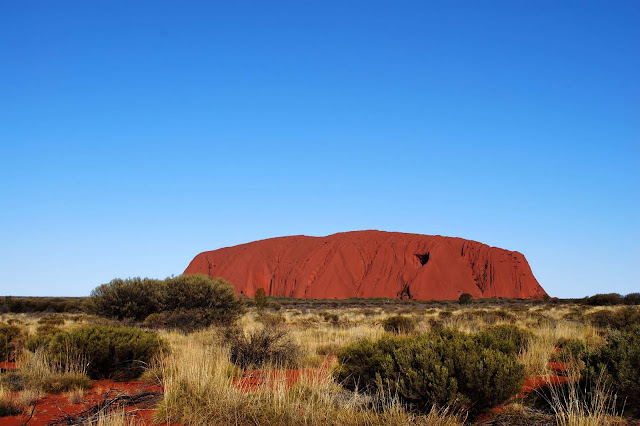
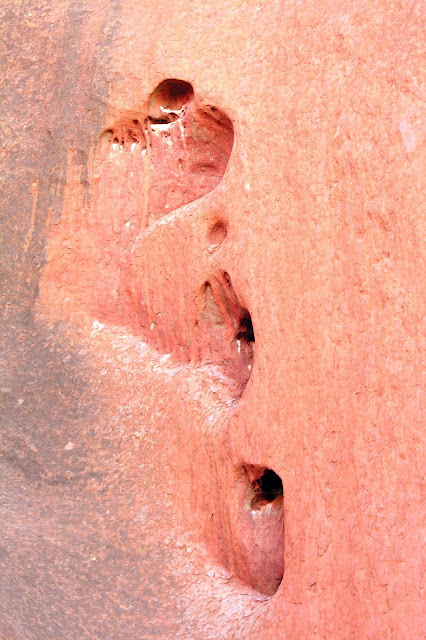
Uluru is a large sandstone rock formation in the southern part of the Northern Territory, central Australia. It lies 335 km (208 mi) south west of the nearest large town, Alice Springs; 450 km (280 mi) by road. Kata Tjuta and Uluru are the two major features of the Uluṟu-Kata Tjuṯa National Park. Uluru is sacred to the Aṉangu, the Aboriginal people of the area. It has many springs, waterholes, rock caves and ancient paintings. Uluru is listed as a World Heritage.

image
Uluru

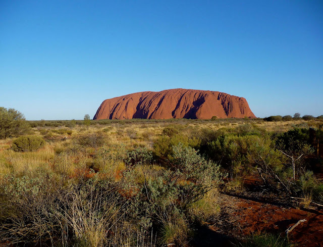
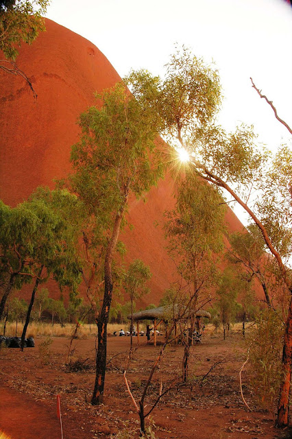
Uluru is one of Australia's most recognisable natural icons. The world-renowned sandstone formation stands 348 m (1,142 ft) high (863 m/2,831 ft above sea level) with most of its bulk below the ground, and measures 9.4 km (5.8 mi) in circumference. Both Uluru and Kata Tjuta have great cultural significance for the Aṉangu traditional landowners, who led walking tours to inform visitors about the local flora and fauna, bush foods and the Aboriginal dreamtime stories of the area.

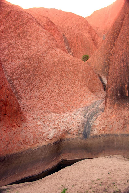
Uluru is notable for appearing to change colour as the different light strikes it at different times of the day and year, with sunset a particularly remarkable sight when it briefly glows red. Although rainfall is uncommon in this semiarid area, during wet periods the rock acquires a silvery-grey colour, with streaks of black algae forming on the areas that serve as channels for water flow.

Kata Tjuta, also called Mount Olga or The Olgas, is another rock formation about 25 km (16 mi) west of Uluru. Special viewing areas with road access and parking have been constructed to give tourists the best views of both sites at dawn and dusk. It is one of the 28 finalists New 7 Word Wonders by Nature.

image

image

image

image

image

image

image

image

image

image

image

image

image

image

Text source:- Wikipedia. Images are copyrighted by their owners. Found any copyright issue, contact the administrator immediately. Report it now!
You have read this article Australia / Heritage / Heritage Australia / Heritage Natural / Mountains / National Parks / Oceania with the title Heritage Australia. You can bookmark this page URL https://tiffanyeatworld.blogspot.com/2011/06/uluru.html. Thanks!