Showing posts with label National Parks. Show all posts

Torres Del Paine National Park

Torres del Paine National Park is a national park encompassing mountains, glacier, lake, and river-rich areas in southern Chilean Patagonia. The Cordillera del Paine is the centerpiece of the park. It lies in a transition area between the Magellanic subpolar forests and the Patagonian Steppes. The park is located north of Puerto Natales and north of Punta Arenas. Bernardo O'Higgins National Park is its neighbour to the west, while Los Glaciares National Park is located to the north in Argentine territory.

image
Torres del Paine National Park

Lady Florence Dixie, in her book published in 1880, gives one of the first descriptions of the area and refers to the three towers as Cleopatra's Needles. She and her party were the first tourists to visit what is now called Torres del Paine National Park. Several European scientists and explorers visited the area in the following decades, including Bryce Bruce, Carl Skottsberg and Alberto María de Agostini. Gunther Pluschow was the first person to fly over the Paine massif.

image

image

The park was established in 1959 as Parque Nacional de Turismo Lago and it was given its present name in 1970. In 1977, Guido Monzino donated 30,000 acres to the Chilean Government, and its definitive limits were established. The park was designated a World Biosphere Reserve by UNESCO in 1978. The landscape of the park is dominated by the Paine massif, which is an eastern spur of the Andes located on the east side of the Grey Glacier, rising dramatically above the Patagonian steppe. Small valleys separate the spectacular granite spires and mountains of the massif.

image

image

The head of French Valley is a cirque formed by impressive cliffs. To west rise abruptly the colossal walls of Cerro Cota 2000 and Cerro Catedral. Cerro Cota 2000 is named for its elevation; its highest contour line is about 2,000 meters. To the north stands the granite arete called Aleta de Tiburon.

image

image

Silence Valley is where standing face to face the gigantic granite walls of Cerro Fortaleza and Cerro Escudo with the western faces of the Torres del Paine. Ascencio Valley is the normal route to reach the Torres del Paine lookout, which is located at the bank of a milky green tarn. The highest mountain of the group is Paine Grande, although its elevation has not been determined with precision yet.

image

image

The Southern Patagonian Ice Field mantles a great portion of the park. Glaciers include the Dickson, the Grey, and the Tyndall. Among the lakes are the Dickson Lake, Nordenskjöld Lake, Pehoe Lake, Grey Lake, Sarmiento Lake, and Del Toro Lake. Only a portion of the latter is within the borders of the park. All are vividly colored, most due to rock flour suspended in their waters. The main river flowing through the park is Paine River. Most of the rivers and lakes of the park drain into Ultima Esperanza Sound via Serrano River.

image

image

image

image

image

image

image

image

Text source:- Wikipedia. Images are copyrighted by their owners. Found any copyright issue, contact the administrator immediately. Report it now!
You have read this article Chile / Mountains / National Parks / Peaks / South America / Wonders / Wonders of the Nature World with the title National Parks. You can bookmark this page URL https://tiffanyeatworld.blogspot.com/2012/03/torres-del-paine-national-park.html. Thanks!

Garajonay National Park

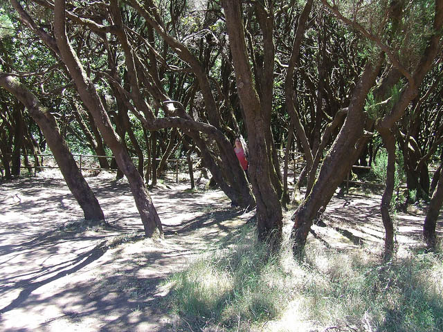
Laurel forest covers some 70% of this park, situated in the middle of the island of La Gomera in the Canary Islands archipelago. The presence of springs and numerous streams assures lush vegetation resembling that of the Tertiary, which, due to climatic changes, has largely disappeared from southern Europe. La Gomera lies to the west of Tenerife, and is one of seven islands that make up the Canary Islands archipelago off the north-west coast of Africa in the Atlantic. The island is accessible by ferry from Tenerife. The park can be reached by road from the island's major towns and villages.

image
Garajonay National Park


image

image

image

image

image

image

image

image

image

image

image

image

image

image

Text source:- Wikipedia. Images are copyrighted by their owners. Found any copyright issue, contact the administrator immediately. Report it now!
You have read this article Europe / Forests / Heritage / Heritage Europe / Heritage Natural / Heritage Spain / Mountains / National Parks / National Parks Europe / Spain with the title National Parks. You can bookmark this page URL https://tiffanyeatworld.blogspot.com/2012/03/garajonay-national-park.html. Thanks!

Los Glaciares National Park

Los Glaciares National Park, created in 1937, is the second largest in Argentina. Its name refers to the giant ice cap in the Andes range that feeds 47 large glaciers, of which only 13 flow towards the Atlantic Ocean. The ice cap is the largest outside of Antarctica and Greenland. In other parts of the world, glaciers start at a height of at least 2,500 meters above mean sea level, but due to the size of the ice cap, these glaciers begin at only 1,500m, sliding down to 200m AMSL, eroding the surface of the mountains that support them.

image
Los Glaciares National Park

Geography
Los Glaciares, of which 30% is covered by ice, can be divided in two parts, each corresponding with one of the two elongated big lakes partially contained by the Park. Lake Argentino, 1,466 km² and the largest in Argentina, is in the south, while Lake Viedma, 1,100 km², is in the north. Both lakes feed the Santa Cruz River that flows down to Puerto Santa Cruz on the Atlantic. Between the two halves is a non-touristic zone without lakes called Zona Centro.

The northern half consists of part of Viedma Lake, the Viedma Glacier and a few minor glaciers, and a number of mountains very popular among fans of climbing and trekking, including Mount Fitz Roy and Cerro Torre.

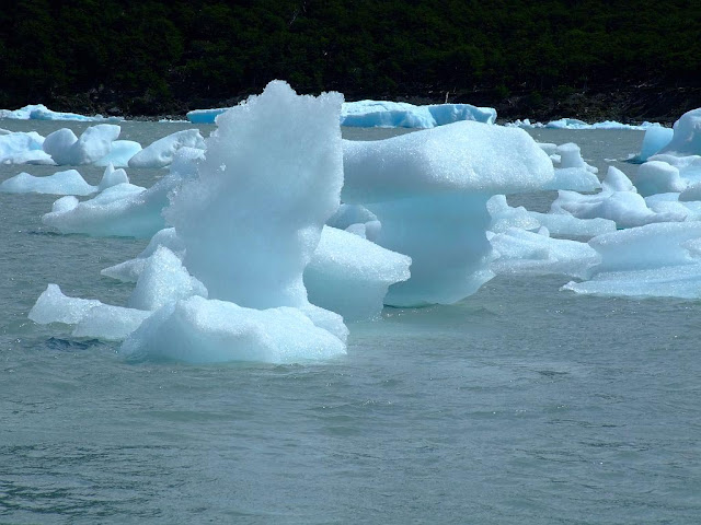
The southern part has, as well as a number of smaller ones, the major glaciers which flow into Lake Argentino: Perito Moreno Glacier, Upsala Glacier, and Spegazzini Glacier. Typical excursion boats travel between icebergs to visit Bahía Onelli, and the otherwise inaccessible Spegazzini and Upsala. The Perito Moreno is reachable by land.

Ecology
The mountains hold most of the humidity from the Pacific Ocean, letting through only the ice coldness (annual average of 7.5 °C) and creating the arid Patagonian steppe on the Argentine side of the range. This area is habitat for ñandúes, guanaco, cougar, and gray fox, the latter who has suffered from the invasion of the cattle industry and are endangered. The guanaco, while not endangered, has had a dramatic decline in historic population due to large scale grazing of livestock throughout much of Patagonia. There are over 1000 species of birds in the area (condors, eagles, and others), but only 100 have been registered. Between the ice and the Patagonian steppe there is a fertile area of Magellanic subpolar forests composed mainly of lengas and guindos, but also ñires. Within these more hospitable areas also live huemul deer and Torrent Duck.

Human use
Los Glaciares is a major attraction for international tourists, and has an annual budget of one million dollars (1994). Starting points of tours are the village of El Calafate at the shore of Lake Argentino but outside the park, where the park's administration has its headquarters, and El Chaltén village in the northern part of the park, at the foot of the Fitz Roy. Other touristic points in the park include Lago del Desierto and Lago Roca.

image

image

image

image

image

image

image

image

image

image

image

Text source:- Wikipedia. Images are copyrighted by their owners. Found any copyright issue, contact the administrator immediately. Report it now!
You have read this article Argentina / Heritage / Heritage Natural / Ice Sheets / National Parks / South America with the title National Parks. You can bookmark this page URL https://tiffanyeatworld.blogspot.com/2012/03/los-glaciares-national-park.html. Thanks!

Crater Lake National Park Oregon

Crater Lake National Park is a United States National Park located in southern Oregon. Established in 1902, Crater Lake National Park is the sixth oldest national park in the United States and the only one in the state of Oregon. The park encompasses the caldera of Crater Lake, a remnant of a destroyed volcano, Mount Mazama, and the surrounding hills and forests.

image
Crater Lake National Park, Oregon

The lake is 1,949 feet deep at its deepest point, which makes it the deepest lake in the United States, the second deepest in North America and the ninth deepest in the world. However, when comparing its average depth of 1,148 feet to the average depth of other deep lakes, Crater Lake becomes the deepest in the Western Hemisphere and the third deepest in the world. The impressive average depth of this volcanic lake is due to the nearly symmetrical 4,000-foot deep caldera formed 7,700 years ago during the violent climactic eruptions and subsequent collapse of Mount Mazama and the relatively moist climate that is typical of the crest of the Cascade Range.

The caldera rim ranges in elevation from 7,000 to 8,000 feet. The United States Geological Survey benchmarked elevation of the lake surface itself is 6,178 feet. This National Park encompasses 183,225 acres. Crater Lake has no streams flowing into or out of it. All water that enters the lake is eventually lost from evaporation or subsurface seepage. The lake's water commonly has a striking blue hue, and the lake is re-filled entirely from direct precipitation in the form of snow and rain.

image

image

image

image

image

image

image

image

image

image

image

image

image

Text source:- Wikipedia. Images are copyrighted by their owners. Found any copyright issue, contact the administrator immediately. Report it now!
You have read this article National Parks / National Parks North America / North America / United States / United States National Parks with the title National Parks. You can bookmark this page URL https://tiffanyeatworld.blogspot.com/2012/03/crater-lake-national-park-oregon.html. Thanks!