Showing posts with label Wonders of the Nature World. Show all posts

Torres Del Paine National Park

Torres del Paine National Park is a national park encompassing mountains, glacier, lake, and river-rich areas in southern Chilean Patagonia. The Cordillera del Paine is the centerpiece of the park. It lies in a transition area between the Magellanic subpolar forests and the Patagonian Steppes. The park is located north of Puerto Natales and north of Punta Arenas. Bernardo O'Higgins National Park is its neighbour to the west, while Los Glaciares National Park is located to the north in Argentine territory.

image
Torres del Paine National Park

Lady Florence Dixie, in her book published in 1880, gives one of the first descriptions of the area and refers to the three towers as Cleopatra's Needles. She and her party were the first tourists to visit what is now called Torres del Paine National Park. Several European scientists and explorers visited the area in the following decades, including Bryce Bruce, Carl Skottsberg and Alberto María de Agostini. Gunther Pluschow was the first person to fly over the Paine massif.

image

image

The park was established in 1959 as Parque Nacional de Turismo Lago and it was given its present name in 1970. In 1977, Guido Monzino donated 30,000 acres to the Chilean Government, and its definitive limits were established. The park was designated a World Biosphere Reserve by UNESCO in 1978. The landscape of the park is dominated by the Paine massif, which is an eastern spur of the Andes located on the east side of the Grey Glacier, rising dramatically above the Patagonian steppe. Small valleys separate the spectacular granite spires and mountains of the massif.

image

image

The head of French Valley is a cirque formed by impressive cliffs. To west rise abruptly the colossal walls of Cerro Cota 2000 and Cerro Catedral. Cerro Cota 2000 is named for its elevation; its highest contour line is about 2,000 meters. To the north stands the granite arete called Aleta de Tiburon.

image

image

Silence Valley is where standing face to face the gigantic granite walls of Cerro Fortaleza and Cerro Escudo with the western faces of the Torres del Paine. Ascencio Valley is the normal route to reach the Torres del Paine lookout, which is located at the bank of a milky green tarn. The highest mountain of the group is Paine Grande, although its elevation has not been determined with precision yet.

image

image

The Southern Patagonian Ice Field mantles a great portion of the park. Glaciers include the Dickson, the Grey, and the Tyndall. Among the lakes are the Dickson Lake, Nordenskjöld Lake, Pehoe Lake, Grey Lake, Sarmiento Lake, and Del Toro Lake. Only a portion of the latter is within the borders of the park. All are vividly colored, most due to rock flour suspended in their waters. The main river flowing through the park is Paine River. Most of the rivers and lakes of the park drain into Ultima Esperanza Sound via Serrano River.

image

image

image

image

image

image

image

image

Text source:- Wikipedia. Images are copyrighted by their owners. Found any copyright issue, contact the administrator immediately. Report it now!
You have read this article Chile / Mountains / National Parks / Peaks / South America / Wonders / Wonders of the Nature World with the title Wonders of the Nature World. You can bookmark this page URL https://tiffanyeatworld.blogspot.com/2012/03/torres-del-paine-national-park.html. Thanks!

New 7 Wonders of Nature

The Amazon Rainforest
The Amazon Rainforest, also known as Amazonia, the Amazon jungle or the Amazon Basin, encompasses seven million square kilometers (1.7 billion acres), though the forest itself occupies some 5.5 million square kilometers (1.4 billion acres), located within nine nations. The Amazon represents over half of the planet's remaining rainforests and comprises the largest and most species-rich tract of tropical rainforest in the world. The Amazon River is the largest river in the world by volume, with a total flow greater than the top ten rivers worldwide combined. It accounts for approximately one-fifth of the total world river flow and has the biggest drainage basin on the planet. Not a single bridge crosses the Amazon.

image

image

image

image

Halong Bay
Halong Bay is located in Quáng Ninh province, Vietnam. The bay features thousands of limestone karsts and isles in various sizes and shapes. The bay has a 120 kilometre long coastline and is approximately 1,553 square kilometres in size with 1969 islets. Several of the islands are hollow, with enormous caves, other support floating villages of fishermen, who ply the shallow waters for 200 species of fish and 450 different kinds of mollusks. Another specific feature of Halong Bay is the abundance of lakes inside the limestone islands, for example, Dau Be island has six enclosed lakes. All these island lakes occupy drowned dolines within fengcong karst.

image

image

image

Iguazu Falls
Iguazu Falls, in Iguazu River, are one of the world's largest waterfalls. They extend over 2,700 m (nearly 2 miles) in a semi-circular shape. Of the 275 falls that collectively make up Iguassu Falls, "Devil's Throat" is the tallest at 80 m in height. Iguazu Falls are on the border between the Brazilian state of Paraná and the Argentine province of Misiones, and are surrounded by two National Parks (BR/ARG). Both are subtropical rainforests that are host to hundreds of rare and endangered species of flora and fauna.

image

image

image

Jeju Island
Jejudo is a volcanic island, 130 km from the southern coast of Korea. The largest island and smallest province in Korea, the island has a surface area of 1,846 sqkm. A central feature of Jeju is Hallasan, the tallest mountain in South Korea and a dormant volcano, which rises 1,950 m above sea level. 360 satellite volcanoes are around the main volcano.

image

image

image

Komodo National Park
Indonesia's Komodo National Park includes the three larger islands Komodo, Rinca and Padar, as well as numerous smaller ones, for a total area of 1,817 square kilometers (603 square kilometers of it land). The national park was founded in 1980 to protect the Komodo dragon. Later, it was also dedicated to protecting other species, including marine animals. The islands of the national park are of volcanic origin.

image

image

image

Puerto Princesa underground river
The Puerto Princesa Subterranean River National Park is located about 50 km north of the city of Puerto Princesa, Palawan, Philippines. It features a limestone karst mountain landscape with an 8.2 km. navigable underground river. A distinguishing feature of the river is that it winds through a cave before flowing directly into the South China Sea. It includes major formations of stalactites and stalagmites, and several large chambers. The lower portion of the river is subject to tidal influences. The underground river is reputed to be the world's longest. At the mouth of the cave, a clear lagoon is framed by ancient trees growing right to the water's edge. Monkeys, large monitor lizards, and squirrels find their niche on the beach near the cave.

image

image

image

Table Mountain
Table Mountain is a South African icon and the only natural site on the planet to have a constellation of stars named after it - Mensa, meaning "the table." The flat-topped mountain has withstood six million years of erosion and hosts the richest, yet smallest floral kingdom on earth with over 1,470 floral species. Table Mountain boasts numerous rare and endangered species. It is the most recognized site in Cape Town, the gateway to Africa, owing to its unique flat-topped peaks which reach 1,086 m above sea level.

image

image

image

image

Text source:- Wikipedia. Images are copyrighted by their owners. Found any copyright issue, contact the administrator immediately. Report it now!
You have read this article Wonders / Wonders of the Nature World with the title Wonders of the Nature World. You can bookmark this page URL https://tiffanyeatworld.blogspot.com/2011/11/new-7-wonders-of-nature.html. Thanks!

Great Barrier Reef

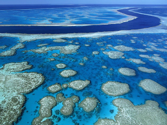
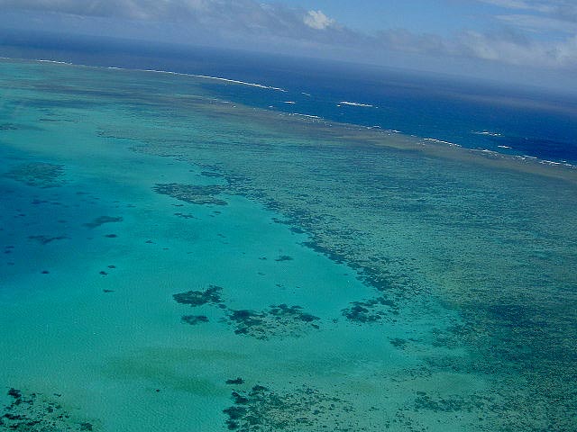
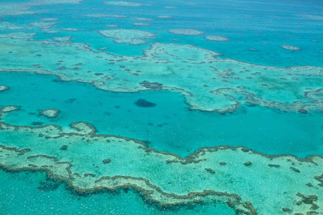
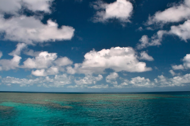
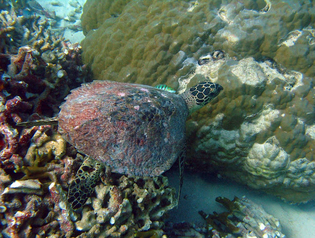
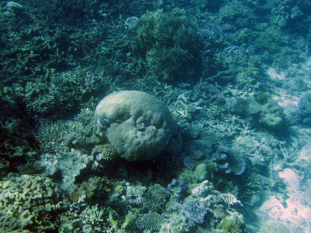
The Great Barrier Reef is the world's largest reef system composed of over 2,900 individual reefs and 900 islands stretching for over 2,600 kilometres (1,600 mi) over an area of approximately 344,400 square kilometres (133,000 sq mi). The reef is located in the Coral Sea, off the coast of Queensland in north-east Australia.

image
Great Barrier Reef

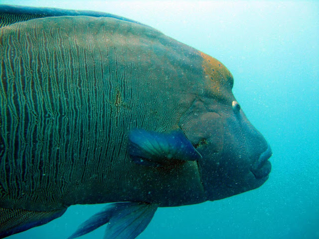
The Great Barrier Reef can be seen from outer space and is the world's biggest single structure made by living organisms. This reef structure is composed of and built by billions of tiny organisms, known as coral polyps. This reef supports a wide diversity of life and was selected as a World Heritage Site in 1981. CNN labeled it one of the seven natural wonders of the world. The Queensland National Trust named it a state icon of Queensland.

A large part of the reef is protected by the Great Barrier Reef Marine Park, which helps to limit the impact of human use, such as fishing and tourism. Other environmental pressures on the reef and its ecosystem include runoff, climate change accompanied by mass coral bleaching, and cyclic population outbreaks of the crown-of-thorns starfish.

The Great Barrier Reef has long been known to and used by the Aboriginal Australian and Torres Strait Islander peoples, and is an important part of local groups' cultures and spirituality. The reef is a very popular destination for tourists, especially in the Whitsunday Islands and Cairns regions. Tourism is an important economic activity for the region, generating $1 billion per year.

image

image

image

image

image

image

image

image

image

image

image

image

image

image

image

Text source:- Wikipedia. Images are copyrighted by their owners. Found any copyright issue, contact the administrator immediately. Report it now!
You have read this article Australia / Ocean / Oceania / Wonders / Wonders of the Nature World with the title Wonders of the Nature World. You can bookmark this page URL https://tiffanyeatworld.blogspot.com/2011/07/great-barrier-reef.html. Thanks!