Golden Temple India

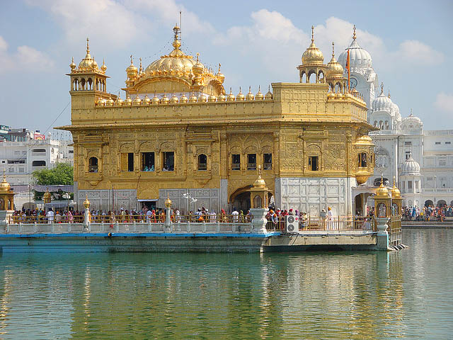
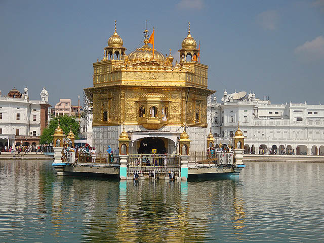
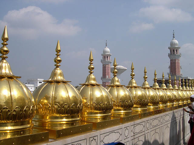
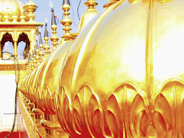
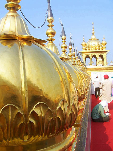
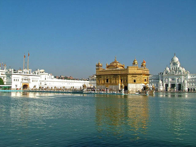
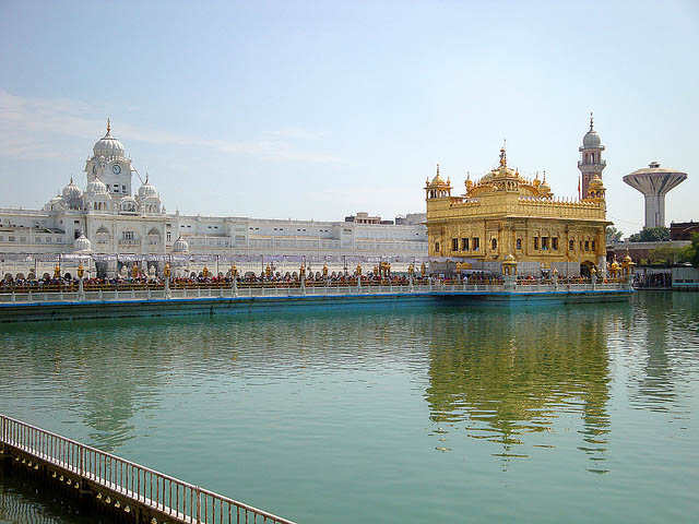
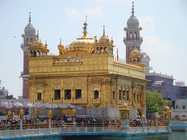
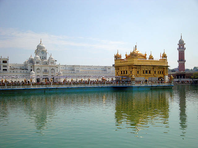
The Harmandir Sahib is a prominent Sikh gurdwara located in the city of Amritsar, Punjab, India. Construction of the gurdwara was begun by Guru Ram Das, the fourth Sikh Guru, and completed by his successor, Guru Arjan Dev. In 1604, Guru Arjan Dev completed the Adi Granth, the holy scripture of Sikhism, and installed it in the Gurdwara. In 1634, Guru Hargobind left Amritsar for the Shivalik Hills and for the remainder of the seventeenth century the city and gurdwara was in the hands of forces hostile to the Sikh Gurus. During the eighteenth century, the Harmandir Sahib was the site of frequent fighting between the Sikhs on one side and either Mughal or Afghan forces on the other side and the gurdwara occasionally suffered damage. In the early nineteenth century, Maharaja Ranjit Singh secured the Punjab region from outside attack and covered the upper floors of the gurdwara with gold, which gives it its distinctive appearance and English name of "Golden Temple".

image
Golden Temple - Amritsar (India)

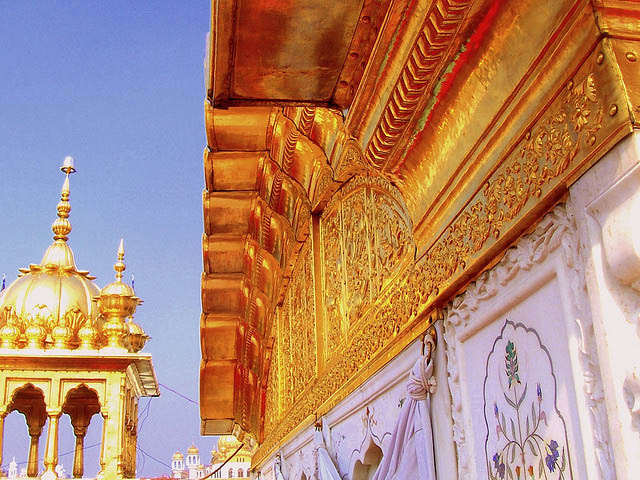
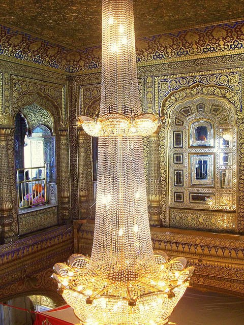
The present day Golden Temple was rebuilt in 1764 by Maharaja Jassa Singh Ahluwalia (1718-1783) with the help of other Misl Sikh chieftains. It was more beautified with adding more architecture. Between 1802-1830 Ranjit Singh did the sewa of gold plating the Temple and adding marble to it as well, while the interior was decorated with fresco work and gemstones.

image
Entrance to Golden Temple, Amritsar

image
The Harmandir Sahib (The abode of God)

Harmandir Sahib is considered holy by Sikhs. The most holy text of Sikhism, the Guru Granth Sahib, is always present inside the temple. Its construction was mainly intended to build a place of worship for men and women from all walks of life and all religions to come and worship God equally.

image

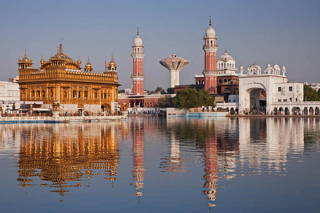
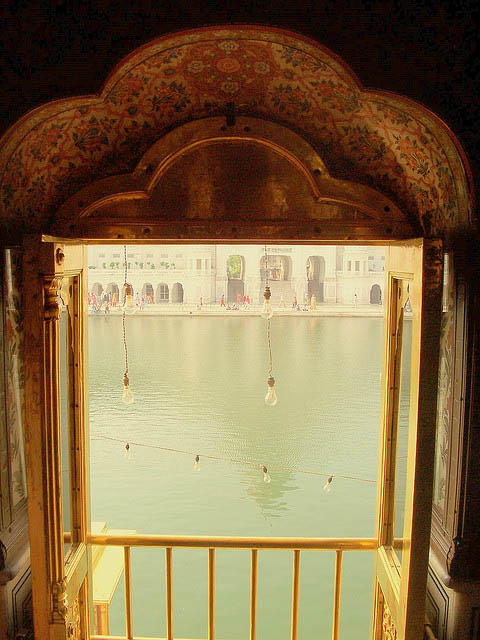
Harmandir Sahib literally means Temple of Gods. The fourth guru of Sikhism, Guru Ram Das, excavated a tank in 1577 CE which subsequently became known as Amritsar (meaning "Pool of the Nectar of Immortality"), giving its name to the city that grew around it. In due course, a splendid Sikh edifice, Harmandir Sahib (meaning "the abode of God"), rose in the middle of this tank and became the supreme centre of Sikhism. Its sanctum came to house the Adi Granth comprising compositions of Sikh gurus and other saints considered to have Sikh values and philosophies, e.g., Baba Farid, and Kabir. The compilation of the Adi Granth was started by the fifth guru of Sikhism, Guru Arjan Dev.

image
Golden Temple at Night

image

image

image

image

image

image

image

image

image

image

image

image

image

image

image

image
Harmandir Sahib Complex

Text source:- Wikipedia. Images are copyrighted by their owners. Found any copyright issue, contact the administrator immediately. Report it now!
You have read this article Asia / India / Temples with the title 2011. You can bookmark this page URL http://tiffanyeatworld.blogspot.com/2011/12/golden-temple-india.html. Thanks!

United Colors of Peacock HD Wallpapers

Peacock HD Wallpaper

Peacock Colorful Wings Features HD Wallpaper

Peacock Awesome Green Features HD Wallpaper

You have read this article Animals / Birds / Colorful / Features / Gallery / Nature / Peacock / Picture / Wallpaper HD / Wings with the title 2011. You can bookmark this page URL http://tiffanyeatworld.blogspot.com/2011/12/united-colors-of-peacock-hd-wallpapers.html. Thanks!

Hierapolis Pamukkale

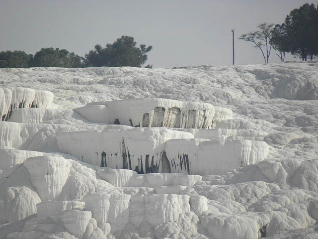
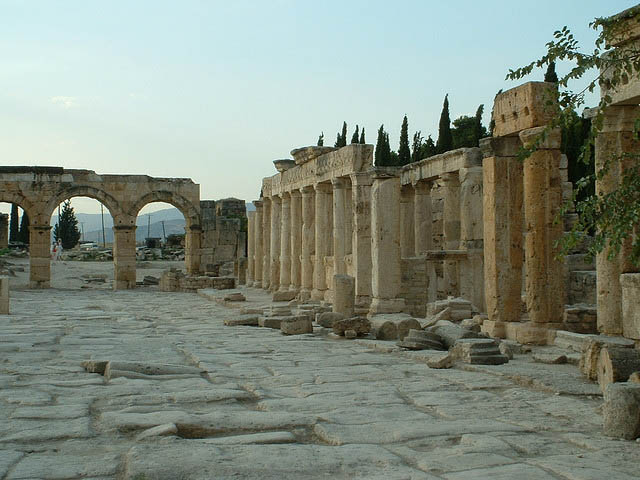
Deriving from springs in a cliff almost 200 m high overlooking the plain, calcite-laden waters have created at Pamukkale (Cotton Palace) an unreal landscape, made up of mineral forests, petrified waterfalls and a series of terraced basins. At the end of the 2nd century B.C. the dynasty of the Attalids, the kings of Pergamon, established the thermal spa of Hierapolis. The ruins of the baths, temples and other Greek monuments can be seen at the site.

image
Hierapolis Ancient City Turkey

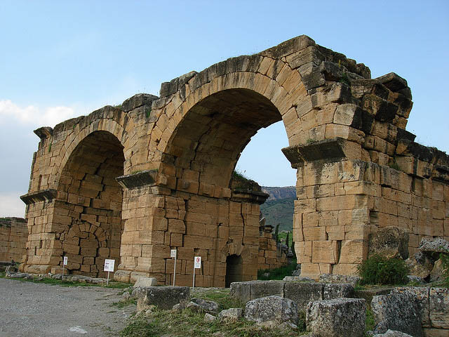
This site is exceptional by vurtue of its superlative natural phenomena - warm, heavily mineralized water flowing from springs creating pools and terraces which are visually stunning. It is on this outstanding natural site that Hierapolis, an exceptional example of a Graeco-Roman thermal installation, was established. The Christian monuments of Hierapolis constitute an outstanding example of an early Christian architectural complex.

image
Cotton Castle , Pamukkale Denizli Turkey

image

image

Pamukkale, which literally means 'cotton castle', is the name the Turks gave to the extraordinary site of Hierapolis. The name was inspired by the preternatural landscape of bizarre forms created by calcite deposits from the hot springs that surface through a fault: mineral forests, petrified cascades and terraced pools of an immense natural nymphaeum. The ancients attributing healing powers to the hot springs (35 °C) equal to their power to metamorphose the landscape, they founded a thermal station on the site in the late 2nd century. The history of Hierapolis followed the same course as many Hellenistic cities in Asia Minor. The Romans acquired full control of it in 129 BC and it prospered under its new rulers. It was a cosmopolitan city where Anatolians, Graeco-Macedonians, Romans and Jews intermingled. The hot springs which attracted throngs of people 'taking the waters' also served another purpose: scouring and dying wool.

image

image

image

The therapeutic virtues of the waters were exploited at the various thermal installations which included immense hot basins and pools for swimming. Hydrotherapy was accompanied by religious practices, which were developed in relation to local cults. The Temple of Apollo was erected on a fault from which noxious vapours escaped. The theatre, which dates from the time of Severus, is decorated with an admirable frieze depicting a ritual procession and a sacrifice to the Ephesian Artemis. The necropolis affords a vast panorama of the funerary practices of the Graeco-Roman epoch. According to ancient tradition, Philip the Apostle converted it and was crucified there by Domitian around the year 87. Hieropolis remained one of the two metropolises of the Phrygia Pacatiana as well as being a bishopric. The group of Christian buildings are the cathedral, baptistry and churches. The most important monument is the martyrium of St Philip. At the top of a monumental stairway, the octagonal layout of the building is remarkable because of its ingenious spatial organization. The fortress, built on the cliff, testifies to its ultimate historic phase.

image

image

The Pamukkale National Park is the focal point for the natural values of the site, formed by its highest travertine terraces, with 20 m high cliffs and waterfalls, and situated along on the foothills of the Cokelez Mountains. The terrace is about 200 m above the Curuksu plain and extends some 6 km between the villages of Pamukkale and Karahayit. Semi-circular pools occur in a step-like arrangement down the upper third of the slope. Fresh deposits of calcium carbonate give the pools a dazzling white coating. The travertine deposits, Quaternary in age, are thought to originate from a fault in the contact zone between the Mesozoic crystalline rocks and the layers of the Neogen series. The springs form part of a complex hydraulic system extending 70 km to the north-west to Alasehir and west along the valley of the Menderes River. These canals take thermal water to nearby villages and agricultural areas, some over the years having accumulated travertine deposits up to 10 m in height. The oldest rocks in the area are crystalline marbles, quartzite and schists and are located in the northern parts of the park. Most of the rocks are of the Pliocene epoch.

image

image

A vegetation map produced in 1969 showed land use, in descending order of area covered, as cultivated land, bare land subject to erosion, bare land urban areas and maquis. There are some 45 species of flowering plant, while in Denizli Province there are records of ten species of mammal and ten species of bird. State ownership around 500 m, rising to 1,840 m in the Cokelez mountains, to the immediate north of the park peaks further out but surrounding the park rise to 2,308 m (Babadağ) and 2,571 m (Honaz).

image

The natural features of the site provide the setting that attracted the original Roman town of Hierapolis. They thus form an important backdrop for the cultural landscape that now dominates the area.

image

image

image

image

image

image

image
Amphitheatre - Hierapolis Ancient City , Turkey

image

Text source:- Wikipedia. Images are copyrighted by their owners. Found any copyright issue, contact the administrator immediately. Report it now!
You have read this article Asia / Asia Heritage / Heritage / Heritage Cultural / Turkey with the title 2011. You can bookmark this page URL http://tiffanyeatworld.blogspot.com/2011/12/hierapolis-pamukkale.html. Thanks!

Tassili Najjer Algeria

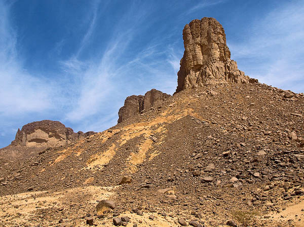
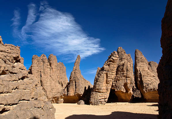
Located in a strange lunar landscape of great geological interest, this site has one of the most important groupings of prehistoric cave art in the world. More than 15,000 drawings and engravings record the climatic changes, the animal migrations and the evolution of human life on the edge of the Sahara from 6000 BC to the first centuries of the present era. The geological formations are of outstanding scenic interest, with eroded sandstones forming ‘forests of rock’.

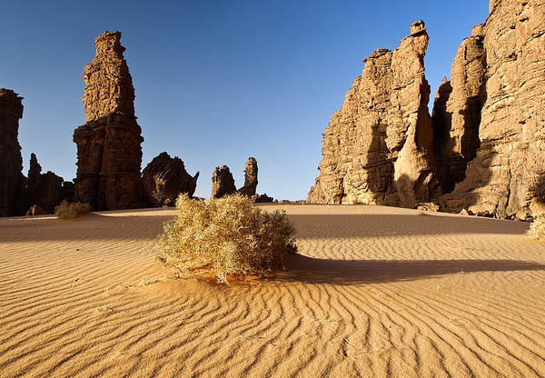
Tassili n'Ajjer is a vast plateau in south-east Algeria at the borders of Libya, Niger and Mali, covering an area of 72,000 sq. km. The exceptional density of paintings and engravings, and the presence of many prehistoric vestiges, are remarkable testimonies to Prehistory. From 10,000 BC to the first centuries of our era, successive peoples left many archaeological remains, habitations, burial mounds and enclosures which have yielded abundant lithic and ceramic material. However, it is the rock art (engravings and paintings) that have made Tassili world famous as from 1933, the date of its discovery. 15,000 engravings have been identified to date.The property is also of great geological and aesthetic interest: the panorama of geological formations with "rock forests" of eroded sandstone resembles a strange lunar landscape.
image
Tassili n'Ajjer, Algeria

image

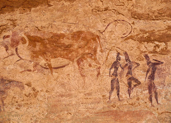
The impressive array of paintings and rock engravings of various periods gives world recognition to the property. The representations of the Round Heads Period evoke possible magic-religious practices some 10,000 years old, whereas the representations of the Cattle Period depicting daily and social life, and which are amongst the most famous prehistoric parietal art, have an aesthetic naturalistic realism. The last images represent the taming of horses and camels.

image

The rock art images cover a period of about 10,000 years. With the archaeological remains, they testify in a particularly lively manner to climate changes, changes in fauna and flora, and particularly to possibilities provided for farming and pastoral life linked to impregnable defensive sites during certain prehistoric periods.

image

With the eroded sandstone forming "rock forests", the property is of remarkable scenic interest. The sandstone has kept intact the traces and marks of the major geological and climatic events. The corrosive effects of water, and then wind, have contributed to the formation of a particular morphology, that of a plateau carved by water and softened by the wind.

image

The geological conformation of Tassili n'Ajjer includes Precambrian crystalline elements and sedimentary sandstone successions of great paleo-geographical and paleo-ecological interest.

image

Humans lived in this area by developing cultural and physiological behaviour adapted to the harsh climate; their vestiges date back to several hundreds of thousands of years. The rock art of Tassili n'Ajjer, is the most eloquent expression of relationships between humans and the environment, with more than 15,000 drawings and engravings testifying to climate changes, wildlife migrations, and the evolution of humankind on the edge of the Sahara. This art depicts water-dependent species like the hippopotamus, and species which have been extinct in the region for thousands of years. This combination of geological, ecological and cultural elements is a highly representative example of a testimony to life.

image

The property contains all the key rock art sites and landscapes representing its natural beauty and all the sites of biological and ecological diversity that compose the attributes of Outstanding Universal Value. The boundaries and the size (72,000 sq. km) of the property ensure the maintenance of the geological process and the cultural heritage integrity of the site.

image

The richness of the cultural heritage of rock art and archaeological vestiges, together with the natural diversity of the ecosystem, fauna, flora and wetlands, fully reflect Outstanding Universal Value. It is vulnerable to deterioration caused by climatic phenomena, and to damage caused by visitors.

image

Given the contemporary geostrategic challenges, and the new patterns of territorial development and rehabilitation of the bordering Saharan regions, and in the framework of the cultural heritage law (Law 98-04 on the Protection of Cultural Heritage), the Ministry of Culture introduced a new category of protection of cultural and natural values: the cultural park - a concept of protection of geographical spaces in which the different cultural and natural values are interlinked and juxtaposed in an intelligible configuration.

image

Based on this identification, rules for organization and management have been defined, as well as the structures and mechanisms that govern these spaces, from the prehistoric cave to the existing urban fabric, in a general territorial development plan, a legal and technical instrument for policy and planning that associates the sectors of culture, the interior and local collectivities, the environment, forests.

image
Tassili n'Ajjer Paintings, Algeria

Thus, sustainable management of the heritage of Tassili is included in the framework of the implementation of the Cultural Heritage Law and its texts of application concerning the creation and organization of the Tassili Park Office, a public establishment of an administrative nature (EPA), the missions of which are the protection, conservation and enhancement of the cultural and natural heritage. This establishment is run by a director appointed by decree, and managed by an Advisory Board which includes representatives of the various ministerial departments and local representatives. It has an annual operating budget for the implementation of the Action Plan, in the framework of a participatory management policy integrating the different partners, and a capital budget for the realization of major development projects and infrastructures.

image

The research programmes underway in the Park respond, firstly, to the major challenges in the conservation of the fragile and vulnerable cultural and natural heritage subjected to extreme weather conditions, then to the demands of socialization, education and the promotion of best practices for the sustainable use of the cultural and natural diversity amongst the park residents. The property management also reflects the strong regional value of Tassili n'Ajjer as one of the essential elements of an ecological belt, which includes plant and animal species typical of the Sahara, as well as tropical and Mediterranean species, adapted to the rigors of the climate. Tourism activity which generates income and jobs for local people is subject to conditions which ensure better use of natural and cultural resources. Tourism is strictly controlled; the groups of visitors are always accompanied by an official guide. One of the long-term imperatives in this immense property will remain tourism management.

image

image

image

image

image

image

image

image

image

Text source:- Wikipedia. Images are copyrighted by their owners. Found any copyright issue, contact the administrator immediately. Report it now!
You have read this article Africa / Africa Heritage / Algeria / Heritage / Heritage Cultural with the title 2011. You can bookmark this page URL http://tiffanyeatworld.blogspot.com/2011/12/tassili-najjer-algeria.html. Thanks!